

Chart Tile Service to Aid Charts Update
NOAA Coast Survey gives commercial navigation systems better tool to receive updated nautical charts. Accessing up-to-date nautical charts on electronic systems and mobile apps is about to get easier, as developers start adopting NOAA Coast Survey's new Chart Tile Service prototype. Navigational chart users should not notice any difference in how their charting systems operate - except that service providers will be able to quickly update the charts with hundreds of corrections applied weekly by NOAA, so users will have the corrected versions faster than ever before. Coast Survey released the NOAA prototype chart tile and metadata service on December 7.
Nautical Chart Updated for Charleston Harbor
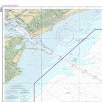
The new nautical chart 11525 extends eastward, to cover an additional pilot boarding area for vessels headed to the Charleston Harbor. Ships entering the Port of Charleston will have a new and improved nautical chart that covers a larger area to ensure safer navigational approaches into the harbor. Available on the 4th of July, new chart 11525 (Charleston Harbor Entrance and Approach) replaces the old chart 11523 (Charleston Harbor Entrance). It expands chart coverage further east, covering an additional 345 square nautical miles that wasn’t on the old chart.
NOAA Nautical Charts Now Permanently Free
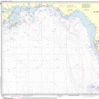
After a three-month trial period, PDF versions of NOAA nautical charts will become a permanent product, free to the public. The free PDFs, which are digital images of traditional nautical charts, are especially valued by recreational boaters who use them to plan sailing routes and fishing trips. The free PDF charts are part of a suite of new and enhanced navigational products designed to make NOAA’s data more accessible to the general public. “Up to date charts help boaters avoid groundings and other dangers to navigation…
NOAA Updates New York Harbor Charts Post-Sandy
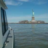
Ships, barges, ferries, and recreational boats in the busy New York Harbor will be able to navigate more safely thanks to an updated version of the harbor’s nautical chart recently issued by NOAA that includes data gathered in the navigational response to the damage caused by Sandy in October 2012. The latest edition of Chart 12334 – New York Harbor includes new depth measurements and shoreline depictions. “This new chart edition is the first product of a multi-year post-Sandy charting plan,” said Rear Admiral Gerd Glang, director of NOAA’s Office of Coast Survey.
NOAA: End of Traditional Paper Nautical Charts

NOAA’s Office of Coast Survey, which creates and maintains the nation’s suite of over a thousand nautical charts of U.S. coastal waters, announced major changes ahead for mariners and others who use nautical charts. Starting April 13, the federal government will no longer print traditional lithographic (paper) nautical charts, but will continue to provide other forms of nautical charts, including print on demand charts and versions for electronic charting systems. “Like most other mariners…
Death Knell for NOAA Traditional Paper Nautical Charts
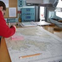
NOAA’s Office of Coast Survey has announced major changes ahead for mariners and others who use nautical charts. Starting April 13, 2014, the federal government will no longer print traditional lithographic (paper) nautical charts . NOAA will continue to provide other forms of nautical charts, including Print-on-Demand paper charts as well as electronic and digital formats. Since 1862, those lithographic nautical charts -- available in marine shops and other stores -- have been printed by the U.S. government and sold to the public by commercial vendors.
NOAA Updates Cobscook Bay Area Chart
Northern Maine vessels will be able to navigate more safely around the dangerous Cobscook Bay thanks to an updated version of the area's nautical chart issued by NOAA. The latest chart includes a new detailed illustration-called a "chart inset"-of the waters around Falls Island, providing safer passage for mariners who transit those waters. While NOAA cartographers had updated Chart 13394 (Grand Manan Channel) over the past several years, using depth measurements and obstruction locations acquired during a major hydrographic survey in 2010, a new inset was needed specifically for Falls Island. "Larger, more detailed scale coverage helps mitigate the dangers to navigation in these areas," explained Cmdr. Shep Smith, chief of NOAA Office of Coast Survey's Marine Chart Division.
Sea Floor Surveys Support Texas Maritime Trade
This winter, NOAA will begin a year-long survey of the sea floor in the Port of Houston and Galveston Bay navigational areas, to aid efforts to bring more trade, more cargo, more jobs, and more economic benefits to the Houston area. The navigation survey team arrived in Galveston this week, to begin pre-survey preparations with mariners and federal partners. "With bigger ships, crowded sea lanes, and more uses of ocean areas, shipping today is increasingly a task of precision and accuracy," explained NOAA Corps Cmdr. Todd Haupt, chief of the Office of Coast Survey's Navigation Response Branch.
NOAA Offers Free Navigational Charts on Web
Mariners can now get free electronic downloads of NOAA (National Oceanic and Atmospheric Administration) Raster Navigational Charts or RNCs. NOAA will produce official raster charts and deliver weekly updates with Notice to Mariners—notices containing changes in local navigational information. The NOAA Web site will contain a fully updated raster chart for each chart in NOAA's suite. A cumulative file of updates with Notice to Mariner information for each chart edition will be posted on the Web site. NOAA will distribute the free raster charts and updates the same way it distributes NOAA electronic navigational charts online. The NOAA Coast Survey anticipates establishing a program where commercial value-added providers may download the raster charts for free…
NOAA Raster Charts Available Online
The National Oceanic and Atmospheric Administration (NOAA) is making available online its Raster Nautical Charts (RNC). These charts are geo-referenced, full-color images of NOAA’s paper nautical charts, published by NOAA in the .BSB format. NOAA updates the RNC for Notices to Mariners on a weekly basis. They are an official product of NOAA and meet the S-61 Standard – Raster Navigational Charts – of the International Hydrographic Organization (IHO). Source: HK Law



