ChartCo Introduces EnviroManager 5.4 At Europort

ChartCo introduced version 5.4 of its EnviroManager.
Already installed on over 500 vessels since its launch in early 2017, EnviroManager consolidates information to assist vessels to comply with MARPOL regulations for discharges and emissions.
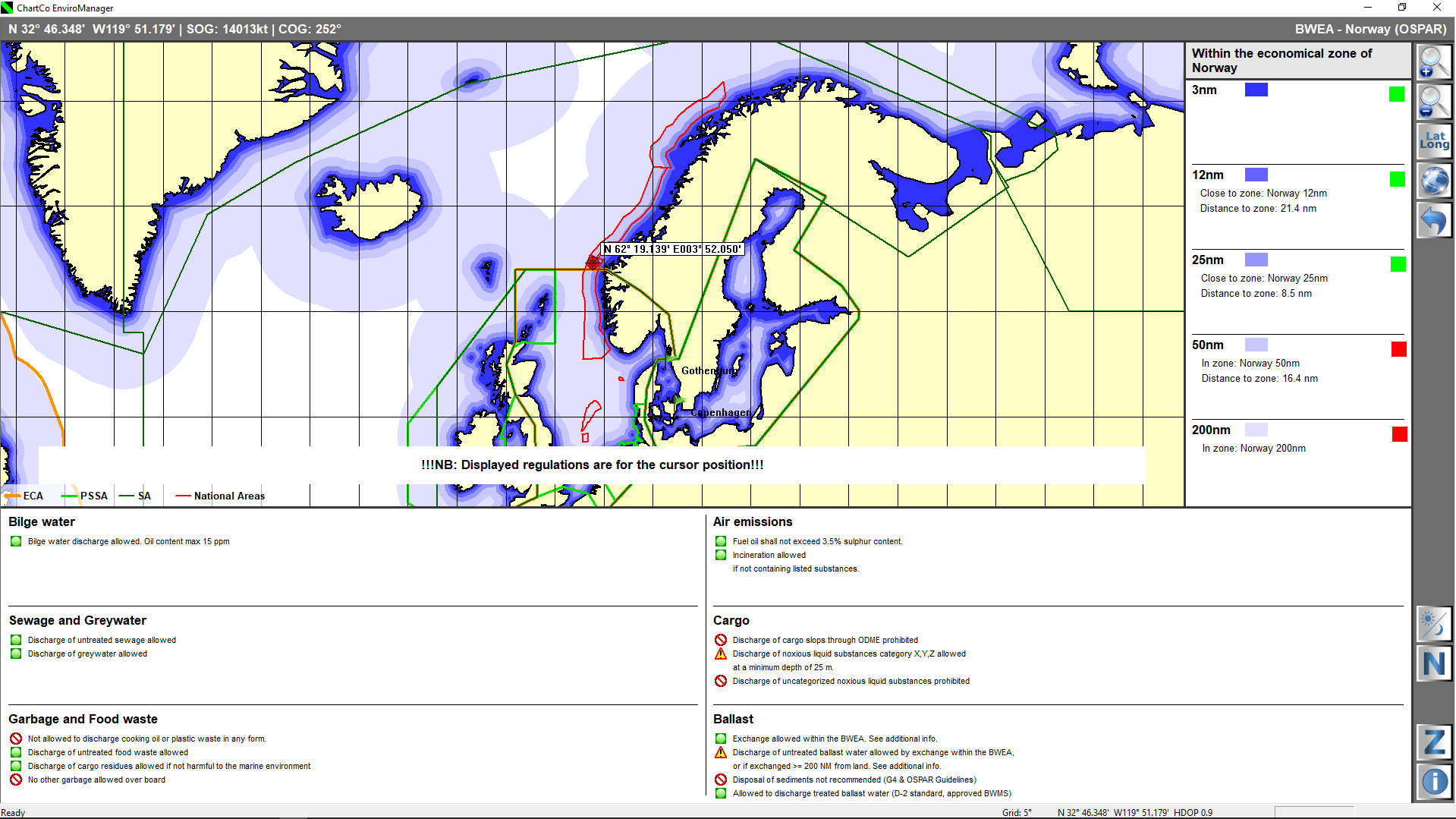
EnviroManager includes the baseline information for each nation as required by regulations. The display shows “distance from land” as measured from the official country baseline, as opposed to the shoreline which is identified on a navigational chart. Skippers using the shoreline distance can unintentionally discharge waste illegally due to being under 3NM from the required baseline. No other system displays this information as comprehensively and clearly as EnviroManager.
The International Convention for the Control and Management of Ships' Ballast Water and Sediments (BWM Convention) entered into force in September 2017. This latest version of the EnviroManager platform integrates all current BWM Convention information including national designated BWEA (Ballast Water Exchange Areas) which are carefully monitored by ChartCo and will be continuously updated. Regional BWM arrangements for the North-East Atlantic, the Baltic Sea Area, the Mediterranean Sea, the ROPME Sea Area and national regulations (including State-specific requirements in the US) have also been integrated with the requirements of the BWM Convention. EnviroManager version 5.4 therefore provides clear assistance to all discharge requirements when operating in different areas and maritime zones.
The various types of discharge are clearly defined by the EnviroManager system and include bilge water, sewage, air emissions, garbage, food waste and ballast. A color coded display advises the crew when discharges are, and are not permitted in any position the vessel is located worldwide.
EnviroManager operates using a GPS feed to show regulations at any given position. A regularly updated geographic database includes all agreed national and international baselines. By using symbols for every presented regulation, EnviroManager is very easy to use, helping the crew to plan the handling of waste efficiently and minimising the risk of a faulty discharge.