Advances in Sea-State Forecasting
Marine operations such as offshore oil and gas operations, renewable energy projects and shipping depend on high quality information on sea-state (wave height, period, direction, steepness) for economic and safety decision making.
The information currently available is based on atmospheric/ocean models and lacks sufficient temporal and spatial resolution.
“Wave conditions are always changing and can vary tremendously over a period of a few hours”, said Chelsea’s Technical Manager, Paul Bolton. “Operators need to know what current conditions are before commencing an operation or lives could be put at risk”.
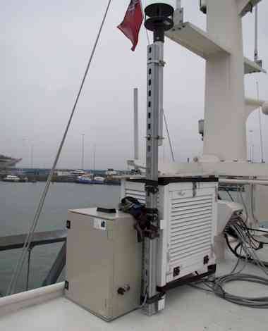
Sensors and electronics, provided by Chelsea have just been installed onboard RV Callista, the University of Southampton’s research vessel, as part of the Technology Strategy Board co-funded WaveSentry project and are now collecting real-time wave data.
Wave data is logged against the GPS position of the boat and will be merged with numerous other data streams by HR Wallingford, to enable more accurate 'nowcasting' and forecasting of sea conditions. Current, forecast and historical data can be portrayed to end users via a variety of means including web-enabled devices and email alerts.
Ending in April 2013, the WaveSentry research and development project is running a pilot system in the English Channel to demonstrate how it can improve upon existing services. The system is designed to accept new sources of wave measurement data to further enhance forecast accuracies. ‘Satellite GNSS Reflectometry’ is one such data source being developed by WaveSentry partners Surrey Satellite Technology Ltd and the Southampton National Oceanography Center. The pilot system will also utilise data gathered by Fugro Emu’s sea bed mounted wave measurement device.


