El Faro’s Voyage Data Recorder Located


 Voyage data recorder next to El Faro mast on ocean floor (Photo: NTSB)
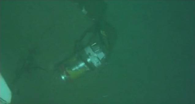
 El Faro wreckage (Photo: NTSB)
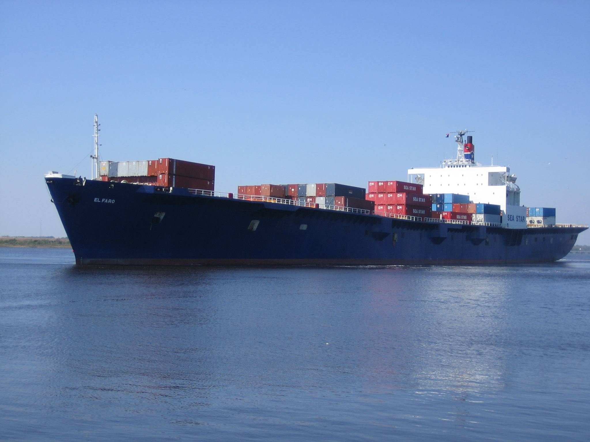
 El Faro (File photo: Tote)
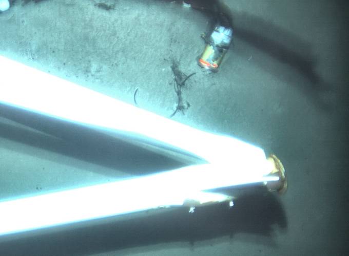
 Screenshot from an NTSB video showing El Faro's VDR in 15,000 feet of water
 El Faro wreckage (Photo: NTSB)
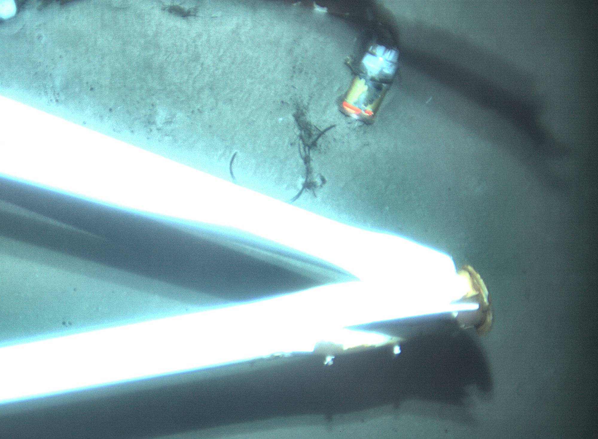
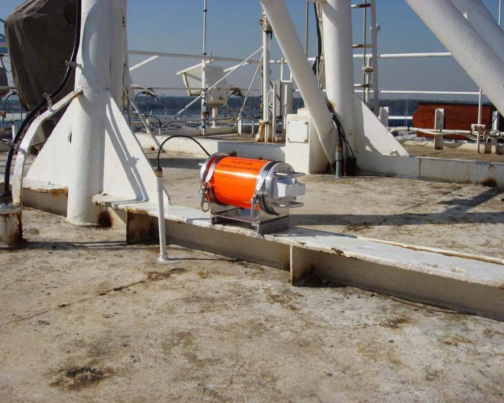
 Voyage data recorder capsule on top of El Faro prior to sinking (Photo: NTSB)

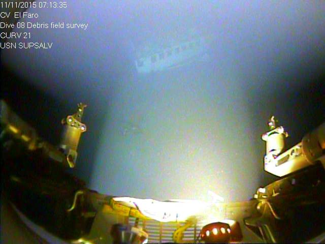
The voyage data recorder (VDR) belonging to sunken cargo ship El Faro was found early Tuesday morning in 15,000 feet of water, about 41 miles northeast of Acklins and Crooked Islands, Bahamas, the National Transportation Safety Board (NTSB) announced.
A specialist team comprised of investigators and scientists from the NTSB, the U.S. Coast Guard, Woods Hole Oceanographic Institution and Tote Services, the owner and operator of El Faro, located the VDR using remotely operated undersea search equipment. Video footage showing El Faro's VDR is available here.
At about 1 a.m. EDT the team aboard the research vessel Atlantis located the El Faro’s mast where the VDR was mounted. After examining numerous images provided by undersea search equipment, the team positively identified the VDR.
“Finding an object about the size of a basketball almost three miles under the surface of the sea is a remarkable achievement,” said NTSB Chairman Christopher A. Hart. “It would not have been possible without the information gained during the first survey of the wreckage and the equipment and support provided by Woods Hole Oceanographic Institution, the National Science Foundation, the U.S. Coast Guard, the U.S. Navy, the University of Rhode Island, and the many other partners involved in this effort.”
The type of VDR mounted on El Faro is capable of recording conversations and sounds on the ship’s navigation bridge, which could provide investigators with important evidence as they seek to understand the sequence of events that led to the sinking.
The 790-foot, U.S.-flagged, cargo ship sank October 1, 2015, during Hurricane Joaquin while sailing from Jacksonville, Florida, to San Juan, Puerto Rico. All 33 crewmembers aboard perished in the accident.
In an earlier mission, investigators identified the vessel and related debris field on the ocean floor but were unable to locate the voyage data recorder. The second mission, in which more advanced sonar and imagery systems were deployed, launched from Charleston, South Carolina April 18. The mission platform is the research vessel Atlantis, which is owned by the U.S. Navy and operated by Woods Hole Oceanographic Institution.
The next step in the ongoing investigation is to determine how the VDR can be retrieved.
The Atlantis will stay at the accident site through April 30 while the team continues the photo- and video-documentation of the sunken ship and debris field before returning to Woods Hole, Massachusetts, on May 5.
As part of the mission, the Inner Space Center at the University of Rhode Island assisted investigators in Washington by establishing a telepresence in the NTSB lab to view underwater imagery in real time and to collaborate with the team on the Atlantis.
The autonomous underwater vehicle Sentry was developed with funding from the National Science Foundation and designed and built at WHOI. Managed by WHOI, the Sentry is operated through the National Deep Submergence Facility, a center funded by the National Science Foundation, the Office of Naval Research, and the National Oceanic and Atmospheric Administration and managed by WHOI. The NDSF operates, maintains, and coordinates the use of deep ocean research vehicles in coordination with the University National Oceanographic Laboratory System, an organization of academic institutions and national laboratories involved in marine research.