

CEACT River Navigation Software Updated


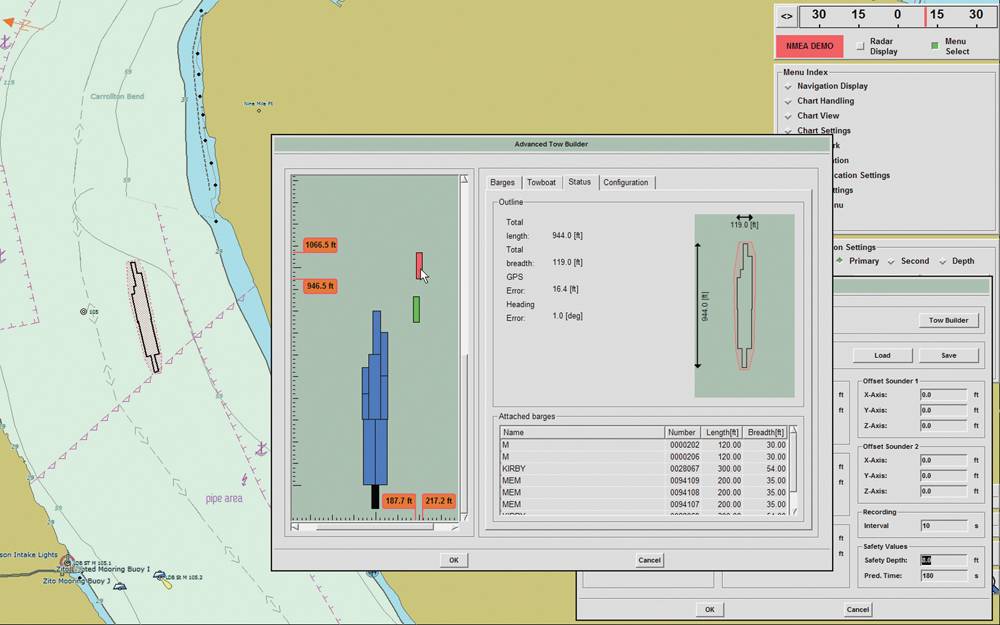
 Exact configuration with graphical interface, showing the barge configuration
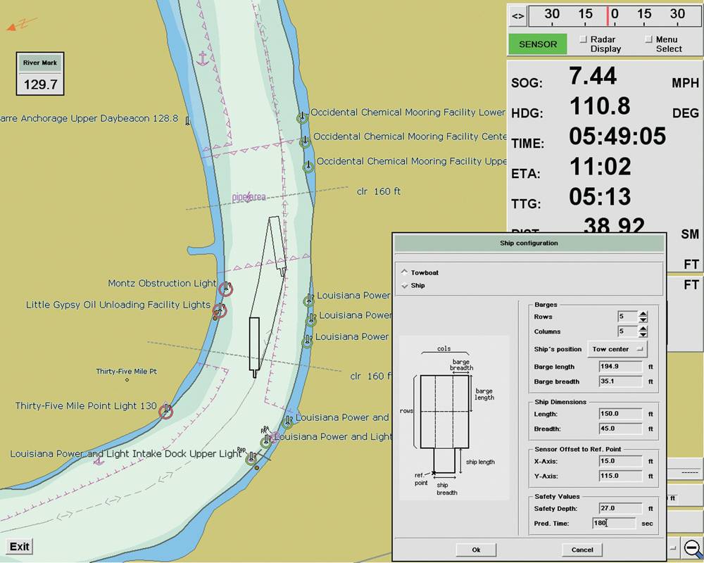
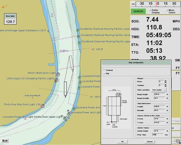 Ship configuration for a precise course prediction
SevenCs and CEACT Information Systems Inc. have announced the latest development of their inland navigation system CEACTTM. The new version includes two new major functionalities. The new version will be available in November 2012. Multiple CPA enables the user to track several AIS targets simultaneously. The operator can toggle between the most relevant targets without re-acquiring. Dangerous targets don’t get lost and the situational awareness is significantly improved.
The second functionality not only improves safety, but also allows the user to save fuel. The Overtaking Calculation shows nicely and easily to understand how long overtaking a vessel will take and mark a position in the chart where it will be completed. Narrow passages, overtaking prohibited areas and upcoming traffic can be identified at a very early stage, allowing timely adjustment of Revolutions per Minute (RPM) and a more fuel-efficient handling of the vessel. Among the improvements implemented in the 2013 version, the enhanced graphic user interface for target tracking is probably the most relevant. Acquiring and reading out target data can now be done with just two clicks and up to four times faster than in previous versions.
SevenCs GmbH develops software for the maritime navigation industry, including the EC2007 ECDIS Kernel, used for navigationally correct chart display, ENC digital chart production tools, plus ECS navigation software for specialist applications, such as portable pilot units and CEACT. Located in Wayne County, WV, CEACTTM stands for Channel ECDIS, AIS & Course Trajectory and is navigation software that is specifically designed for professional tow boats and workboat operations within the confined waterways of the US inland river system. The first CEACTTM system was launched in 2001. Based on its unique combination of inland waterway and tow boat features that saves user money and also enhances safety, CEACTTM has become one of the most common inland navigation systems in the US – used by over 400 tow boats and barge companies such as AEP and Ingram Marine – and is now utilized internationally on inland river systems in Latin America and South East Asia.
(As published in the November 2012 edition of Marine News - www.marinelink.com)


