

UAF’s GINA Provides a Guiding Hand in Arctic Ocean Research


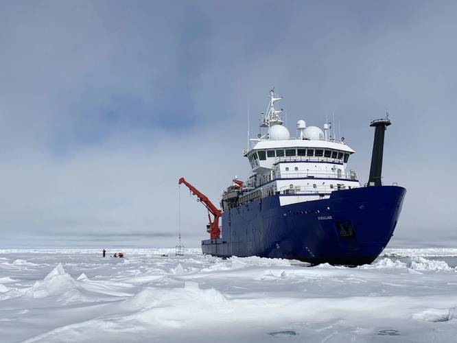 The Sikuliaq, a 261-ft. ice-capable research vessel operated by UAF, pauses in the Arctic Ocean in June 2021 during its fifth year of operation. Photo by Ethan Roth
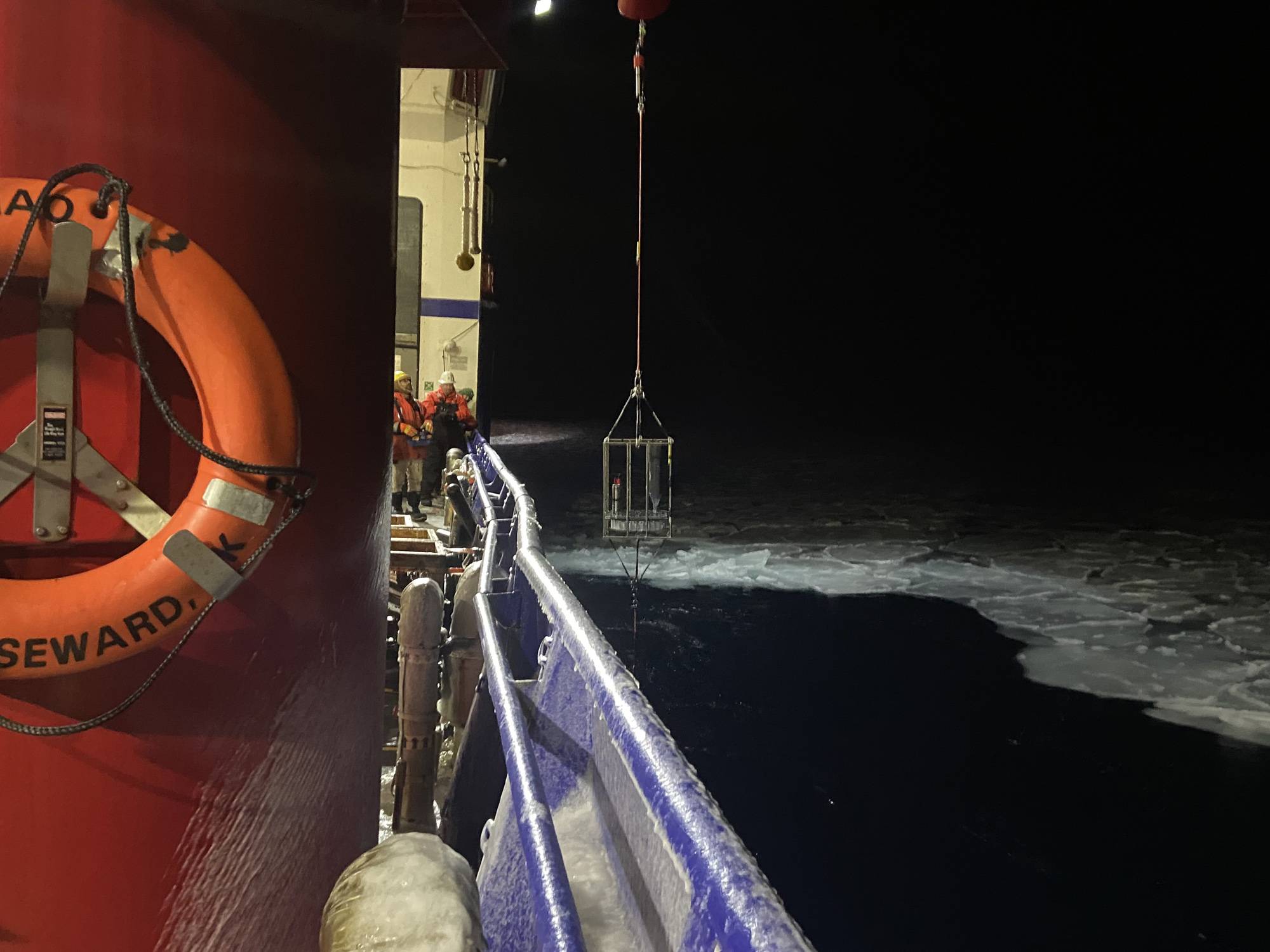
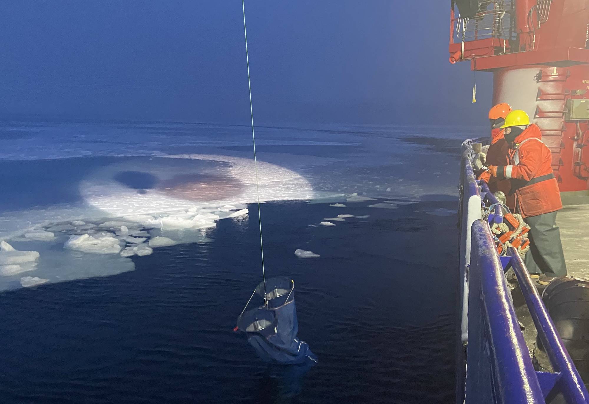
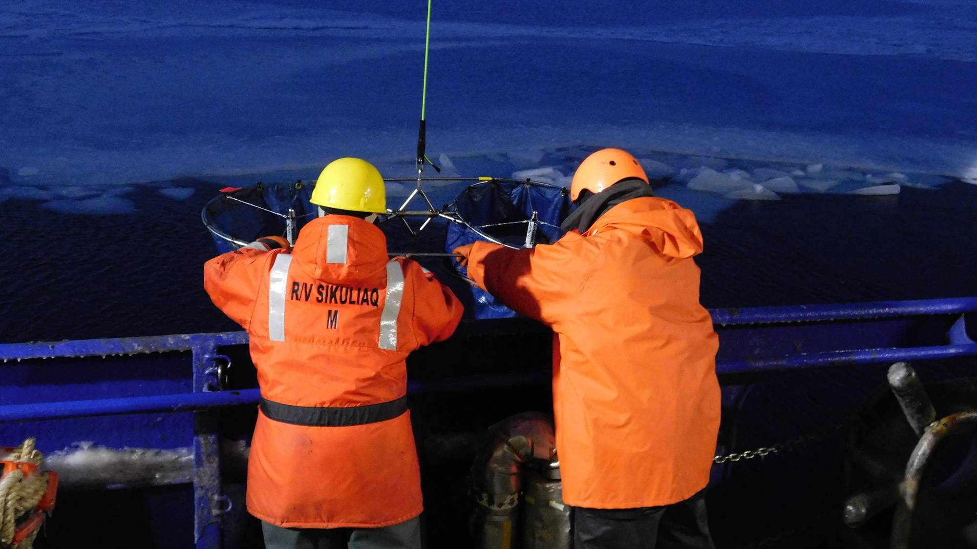
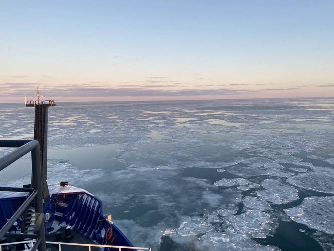 Photo credit: Seth Danielson, chief scientist
 Photo credit: Seth Danielson, chief scientist
 Photo credit: Seth Danielson, chief scientist
 Photo credit: Seth Danielson, chief scientist
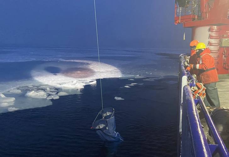 Photo credit: Seth Danielson, chief scientist
 Photo credit: Seth Danielson, chief scientist


The research vessel Sikuliaq navigated among and around the chunks and slabs of Arctic sea ice above Alaska for several weeks on two voyages this fall, breaking through frozen slabs when it had to, just as its sturdy hull is designed to do. It's now on a third trip.
The Sikuliaq, a 261-ft. ice-capable research vessel operated by UAF, pauses in the Arctic Ocean in June 2021 during its fifth year of operation. A few months later, it traveled farther north than ever before — almost 500 miles beyond Point Barrow.
Satellite imagery produced at the Geographic Information Network of Alaska, or GINA, at the University of Alaska Fairbanks Geophysical Institute helps the Sikuliaq weave its way through the ice.
The satellite images, along with satellite data from other sources, show up on the Sikuliaq’s bridge in an easy-to-use web-based map server. The map server has been on the Sikuliaq since 2013, when the ship was built.
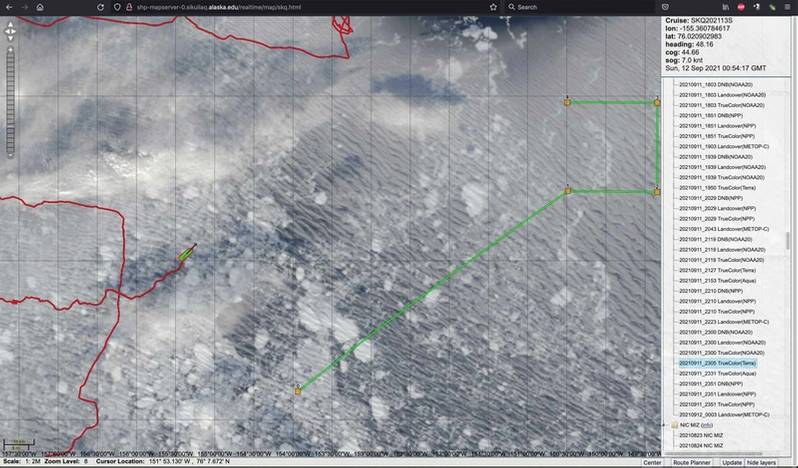 GINA radar image: An image from the map server shows the Sikuliaq amid the sea ice on Sept. 12, 2021. Photo by Steve Roberts
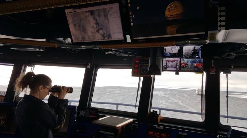 Scanning for ice: GINA images in the ship's map server can be viewed via an overhead monitor above the main console. This helps deck officers navigate in the ice pack by matching features visible in ice radar with the same features seen in the satellite imagery. Crew member Johna Winters, a master’s student in marine resource management at Oregon State University, surveys the ice. Photo by Steve Roberts
Steve Roberts, the Sikuliaq’s science systems engineer, got the idea for the map server while working aboard the USCGC Healy, the Coast Guard’s icebreaker, and has refined his system over the years.
“I remember every day scientists on the Healy continually saying, “Where are we?’,” he said from aboard the Sikuliaq as it sailed in ice-strewn waters about 350 miles north of Alaska. Ice occasionally banged the hull as he spoke. “There was nothing on the ship that provided information relative to the science missions. We need to know where we are relative to science stations and moorings.
“When you are working in ice, the ice controls where you are,” he said. “Knowing where sea ice is at all times is critical.”
 Photo credit: Seth Danielson, chief scientist
Eyes in the Sky
Navigating sea ice is a burgeoning field of interest as shipping increases in the Arctic, which is becoming increasingly open though not entirely ice-free. Icebergs from coastal sources still bob along, and thick slabs of sea ice still drift.
The National Snow and Ice Data Center notes that satellites have only been continuously monitoring sea ice since 1979. Prior to that, captains had to rely on their crews’ firsthand observations and on weekly ice charts based on airborne observations and reports from observers on the coasts and other ships.
Avoiding the ice is often best for the scientists, who usually have a limited amount of time to get what they need from the open water. That was the situation on a seven-week research voyage UAF geophysics professor Bernard Coakley took into the Chukchi and Beaufort Seas and with a Navy-funded voyage in some of the same waters.
Satellite information retrieved from GINA and displayed in Roberts’ tool, along with other information sources, also helps improve the safety, effectiveness and efficiency of the Sikuliaq’s voyages. The National Science Foundation owns the Sikuliaq, a part of the U.S. academic research fleet, and the UAF College of Fisheries and Ocean Sciences operates the ship.
“There’s tight interaction between the navigator and the scientists,” Roberts said. “Scientists can determine where the ship goes, but a lot of times it’s the ice that decides.”
“Scientists need to maintain situational awareness of the conditions,” he said. “And that's the purpose of this tool: to allow us to maintain situational awareness for scientists and for driving the ship.”
 Photo credit: Seth Danielson, chief scientist
How it works
Satellite imagery is acquired by two fundamental types of sensors: passive and active.
Passive sensors monitor radiation in specific wavelengths continually emitted from the Earth, either at the surface or from the atmosphere.
Active sensors such as synthetic aperture radar emit signals that travel through clouds, bounce off the Earth’s surface and return to the sensor.
Data from each type of sensor can be processed into different products for different uses.
GINA uses data from passive-sensor satellites in the National Oceanic and Atmospheric Administration’s Joint Polar Satellite System.
Acquiring imagery through the GINA system in Fairbanks enhances the usefulness of Roberts’ map server. Although the map server relies heavily on cloud-penetrating SAR imagery that shows the ice in great detail, SAR satellites image the same area just once every day or less often. Such infrequency means data from a dynamic Arctic Ocean can be quickly outdated.
Images via GINA can capture the same area more frequently because the images cover a wider area than those of a SAR satellite. But the surface in a GINA image sometimes might be obscured by clouds.
There’s also the benefit of GINA being located in Fairbanks.
“We have antennas located in places like Interior Alaska and the technology to deliver these products right after the satellites fly overhead,” said Jennifer Delamere, director of the Geographic Information Network of Alaska. “In previous years it would have taken hours or days to get the information.”
“This is just a great example of UAF research helping the Sikuliaq get around in the ice. And it’s taking advantage of local technology, both what Steve developed and GINA data, on the bridge of the ship,” she said.
Delamere added that the Geographic Information Network of Alaska provides support for many operations in addition to those of the Sikuliaq.
GINA data is also used by the Alaska Sea Ice Program to analyze sea ice extent and characteristics, by firefighting agencies to show wildfire activity and by other agencies to show volcanic ash, river ice and flooding, and precipitation.
“GINA is ready to help whoever and whenever — whether it’s for something on land, in the atmosphere, or way out at sea,” Delamere said.
Excerpted with permission from the University of Alaska Fairbanks Geophysical Institute. As published in the November/December edition of Marine Technology Reporter
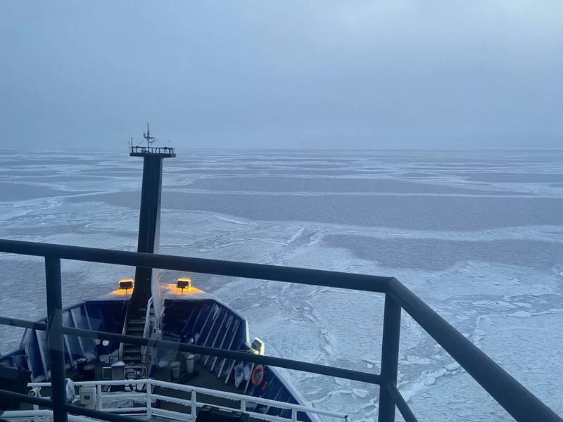 Photo credit: Seth Danielson, chief scientist


