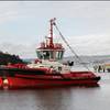
A team of international scientists, led by the Marine Institute in Ireland, has completed a transatlantic sea bed mapping exercise, which has revealed previously uncharted seabed features including mountains and ridges taller than Carrauntoohil.
Footprints of icebergs moving across the seabed, an ancient glacial moraine and a mountain higher than Carrauntoohil in Co Kerry have been mapped across the Atlantic by the team of scientists on board the State’s research ship, the MV Celtic Explorer.
It followed the route taken by ships dropping the first transatlantic telecommunications cable between Ireland and Newfoundland in Canada in 1857.
The project is one of the first to be carried out by the Atlantic Ocean Research Alliance, set up two years ago, on foot of the signing of the Galway Statement on Atlantic Ocean Cooperation.
There were five attempts to lay the first communications link between Europe and the US. However, the ships taking part had little of the crucial "hydrographic information" now available to show the hazards involved.
“We know now why that first cable didn’t last,” Marine Institute geophysicist Tommy Furey said, outlining the details of the three-dimensional seabed images gathered during the week-long survey.
The team from Marine Institute and Geological Survey of Ireland (INFOMAR -national seabed mapping programme), the Fisheries and Marine Institute of Memorial University of Newfoundland, Canada, the United States' National Oceanic and Atmospheric Administration (NOAA), and the Portuguese Institute for Sea and Atmosphere (IPMA), used the latest multi-beam echo sounder technology on the Celtic Explorer to create high resolution images of dramatic seabed features.
They uncovered 235km2 of iceberg scarred seabed, ancient glacial moraine features, and buried sediment channels on the Newfoundland and Labrador shelf. They charted a 15km long down-slope channel feature on the western Atlantic continental slope, most likely formed by meltwater run-off associated with ice cap grounding during the last glaciation, approximately 20,000 years ago.
They crossed the dramatic Charlie-Gibbs Fracture Zone on the Mid-Atlantic Ridge creating a 3D visualization of a 3.7km high underwater mountain. Continuing eastward a straight asymmetric ridge feature came to life standing proud from the flat seabed over 140km long, peaking at 1108m high, taller than Carrauntoohil.
The MV Celtic Explorer team used the latest multi-beam echo sounder technology in the survey, which allowed features already identified in satellite images to be charted in far greater detail than they could have been even 15 years ago.


