

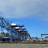
Australia Begins First Live S‑100 Bridge Trial

Australia has commenced its first live shipboard trial of S‑100 digital navigation data, with dynamic tidal and current information now being tested on the bridge of operational cruise vessels in Sydney Harbour.S‑100 is the international standard for next‑generation digital marine navigation, developed by the International Hydrographic Organization. It enables multiple interoperable data layers — such as charts, tides, currents and water levels — to be displayed together on a ship’s bridge…
Report: Many Bridge Teams Struggle with ECDIS Functions

Two years after launching its ECDIS Training Assessment (ETA) platform, NorthStandard draws on cumulative assessment data in a new report which includes key insights on the way shipping can improve ECDIS proficiency on the bridge.Assessments found two-thirds of bridge teams could not identify electronic navigational chart (ENC) updates, and nearly half did not prioritize correct ENC scale in planning. Many also struggled to distinguish alarms from alerts, spot datum issues and verify positions…
LEO Satellite Networks: Supporting Maritime Safety, Efficiency and Innovation

Across the maritime sector, the availability of data has never been higher. Supported by new data collection technologies and advanced analytics, mariners are gaining access to increasingly detailed information on the marine environment. Smart sensors are also becoming more widespread, enabling real-time monitoring of on-board equipment and cargo. Combined, these insights have the potential to provide both mariners and shore-based teams with greater situational and operational awareness throughout voyages.However…
UKHO Partners with Shom to Launch International S-100 Sea Trials Program

The UK Hydrographic Office (UKHO) has launched an international sea trials program in partnership with the French Hydrographic and Oceanographic Service (Shom). The joint program represents the most comprehensive test of S-100 data standards to date and will form part of the International Hydrographic Organization’s (IHO) coordinated test bed framework. Throughout the trials, the UKHO and Shom will collect evidence to inform safety and efficiency use cases, while providing guidance on the introduction of the S-100 data framework, which is set to underpin the future of maritime navigation.
UKHO to Host ‘S-100 in focus’ Panel at London International Shipping Week 2025
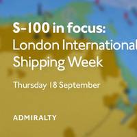
The UK Hydrographic Office (UKHO) will host an in-person panel discussion during London International Shipping Week (LISW) 2025, bringing together expert voices from across the maritime industry to explore the next generation of navigation standards. Titled "S-100 in focus," the session will take place on Thursday, September 18, 2025, at Sea Containers, London, and is free to attend with advance registration. The event will examine the maritime sector’s transition to the S-100 framework, designed by the International Hydrographic Organization (IHO).
Captain Ahmed Al Badi receives 2025 Alexander Dalrymple Award
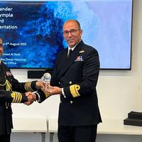
On Wednesday, August 6, 2025 the UK Hydrographic Office (UKHO) presented Captain (Aqeed) Ahmed Al Badi, Head of the Oman National Hydrographic Office (ONHO), with the Alexander Dalrymple Award for 2025. The award recognizes his services to hydrography. Captain Ahmed Al Badi was invited to the UKHO where he was presented with this year’s award. Hosted by the UK’s National Hydrographer and Director of Data Acquisition and Defence, Rear Admiral Angus Essenhigh OBE, the presentation was attended by members of the wider UKHO team…
S-100 has Value Beyond ECDIS
The S-100 framework is a new global standard created by the International Hydrographic Organization (IHO), in collaboration with other hydrographic offices around the world, that enables the integration of diverse datasets within a single Electronic Chart Display and Information System (ECDIS).Mariners will be able to combine various data layers with Electronic Navigational Charts including detailed depth information and dynamic information on tides and currents.S-100 builds on the digital foundation of S-57, the standard for electronic navigational charts since 1992.
Voyage Optimization Plan Led to Grounding of Bulk Carrier
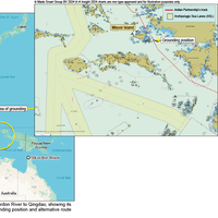
The UK Marine Accident Investigation Branch (MAIB) has released its preliminary assessment of the grounding of the bulk carrier Indian Partnership on April 23, 2023, and implicated voyage optimization planning.The UK-registered bulk carrier ran aground at 0409 off the coast of Misool Island while transiting the Indonesian archipelago. The grounding caused significant breaches to the hull, leading to water ingress into the duct keel and five ballast water tanks.Indian Partnership had set sail from Skardon River…
UK Chamber of Shipping names Hatcher Chief Executive
The UK Chamber of Shipping announced the appointment of Rhett Hatcher as its next chief executive, replacing Sarah Treseder.Hatcher has recently retired from the Royal Navy. He brings with him a broad wealth of experience. His last role was as the UK National Hydrographer and Deputy Chief Executive at the UK Hydrographic Office. He gained a thorough understanding of Whitehall while in senior appointments at the Ministry of Defense, where he was responsible for global strategy…
UKHO Appoints Marion Leslie as Non-Executive Chair

The UK Hydrographic Office (UKHO) confirmed the appointment of Marion Leslie as Non-Executive Chair. Leslie will chair the UKHO Board in this independent position after a year as interim Non-Executive Chair and six years as a Non-Executive Director at the UKHO.The Board supports, challenges and validates the UKHO business strategy and oversees the organization's performance. Leslie leads the Board as Chair, acting in the interests of the Ministry of Defense and key stakeholders…
UKHO to Stop Paper Chart Production in 2026
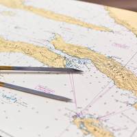
The death of the paper chart may finally be coming to fruition, as the UK Hydrographic Office (UKHO) announced its intention to develop options for the withdrawal from global paper chart production by late 2026, as commerical and pleasure boating use of electronic charts continues full steam ahead, and theADMIRALTY Maritime Data Solutions digital navigation portfolio can be updatedin near real-time, greatly enhancing safety of life at sea (SOLAS). The phased withdrawal of paper…
UKHO Launches ADMIRALTY Small Craft Charts Service
The UK Hydrographic Office (UKHO) has launched its ADMIRALTY Small Craft Charts service - formerly known as ADMIRALTY Leisure Chart Folios – to bring important safety, quality and flexibility benefits to all marine users who depend on these charts.The launch of this new service follows the announcement in May 2021 that UKHO will withdraw the regional folio structure for these charts. Instead users can purchase only those charts that are relevant to their needs without being required to purchase the full regional folio.Through this updated product…
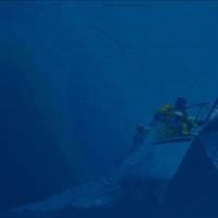
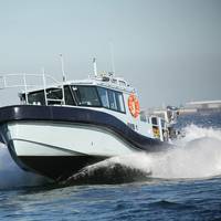
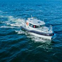
Need a Survey? There’s a USV for That
While the adoption of unmanned/uncrewed surfaces vessels (USVs) was initially in defence, use of these low footprint systems has spread into other sectors, not least survey, and now the race is on for greater capability, endurance and autonomy. Elaine Maslin reports.After starting small, in inland waterways, use of USVs for survey operations has moved into coastal and now offshore waters. Given the extensive amount of seabed and rapid growth in offshore wind, there’s plenty of work out there for them to do.With the travel restrictions posed by Covid and increasing awareness of climate change…
UK Hydrographic Office Appoints Peter Sparkes as Chief Executive

The U.K. Hydrographic Office (UKHO) announced the appointment of Rear Admiral Peter Sparkes as the new chief executive and accounting officer. Sparkes will be leaving the Royal Navy to take up the role.As chief executive, Sparkes will continue to lead the organization’s important work in supporting safe, secure and thriving oceans. This includes the UKHO’s work in support of Defense and merchant shipping. Working in close collaboration with national and international partners…
Geollect Wins ADMIRALTY Maritime Insurance Innovation Challenge
The UK Hydrographic Office (UKHO) announced geospatial intelligence technology provider Geollect as the winner of the second ADMIRALTY Marine Innovation Program challenge.Launched last year in collaboration with RE_SET, the program aims to help start-ups and innovators develop new solutions that support safe, secure and thriving oceans. The program’s second innovation challenge focused on ‘Transforming Maritime Risk & Insurance’, with entrants tasked with identifying, trialing and proving how marine geospatial data can be used to enhance maritime insurance products.For this challenge…
Paramount Launches another Boat for S. African Navy
Paramount Maritime launched its second of three next-generation Survey Motor Boats (SMBs) for the South African Navy in a move that will enhance the capabilities and infrastructure of the South African Navy Hydrographic Office (SANHO). This follows the launch of the first Survey Motor Boat to the South African Navy in August 2020.Veecraft Marine, a subsidiary of Paramount Maritime, had been tasked with the design and manufacture of the three Survey Motor Boats, all of which having taken place in their shipyard in Cape Town…
New Survey Boat Launched for South African Navy
Paramount Maritime, a Paramount Group company, said it has launched the first of three next-generation Survey Motor Boats (SMBs) to the South African Navy in continued support of its programs to enhance the capabilities and infrastructure of the South African Navy Hydrographic Office (SANHO).In addition to the three Survey Motor Boats to be delivered to the South African Navy Hydrographic Office (SANHO), this program also provides for the delivery of a Hydrographic Survey Vessel and a Sea Boat as well as a third…
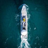
Fugro's New USV to Chart Waters Off South Australia
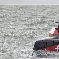
Fugro will use its new uncrewed surface vessel (USV) to chart the waters of South Australia’s Gulf St Vincent and Investigator Strait as part of the Australian Government’s HydroScheme Industry Partnership Program (HIPP).The Dutch-based offshore survey services company will carry out the 998 km2 survey will be conducted on behalf of the Australian Hydrographic Office (AHO), which will use the data to update nautical charts for safer navigation. Data will also be shared with scientific agencies…
UKHO Taps Sparkes as Acting Chief Executive
The U.K. Hydrographic Office has announced the appointment of Rear Admiral Peter Sparkes, the current U.K. National Hydrographer and Deputy Chief Executive, to the position of acting chief executive and accounting officer.Sparkes will hold the position while a permanent replacement is sought for Tim Lowe CBE, the previous UKHO chief executive and accounting officer, who announced his retirement Friday.Commenting on Lowe’s retirement, Sparkes said, “On behalf of the senior leadership team and all at the U.K.
ICS Readies for its Flagship Conference
The world's principal shipping organization International Chamber of Shipping (ICS) has added further high-level speakers to the line-up of its 2019 Conference: Setting Course for 2050: Powering Global Trade. The flagship conference will take place on September 11th at the British Library, during London International Shipping Week, informed the industry body representing around 80% of the world’s merchant tonnage, through membership by national shipowners' associations.Stuart Neil, Communications Director of the International Chamber of Shipping (ICS) said: “The shipping industry is facing the most important transformation since the transition from sail to steam. There are no clear solutions, no silver bullets and there will be trade-offs and new ways of working as we move towards 2050.
UK Holds Maritime Seminar
The UK Hydrographic Office (UKHO) yesterday (5th February) launched a five-day capacity building seminar to help UK Overseas Territories support safe maritime trade.The seminar, delivered as part of the Government’s Overseas Territories Seabed Mapping Programme, will focus on international regulations, with sessions on maritime safety information training, best practice governance and maritime law. This guidance, given by experts at both the UKHO and MCA, will help each of the 10 participating territories to comply with international obligations and share their own maritime safety information with ships operating in their waters.For these ships, this information, including up-to-date bathymetry (seabed mapping data), navigational warnings and observations, is essential to safe navigation.
UK Hydrographic Office Welcomes Maritime 2050 Strategy
The UK Hydrographic Office (UKHO) has welcomed the publication of the UK government’s ‘Maritime 2050’ strategy paper, which sets out the vision for the future of the UK maritime sector.The strategy, which has been developed in consultation with agencies including the UKHO and the wider public and private sectors, sets out a series of detailed recommendations to help the UK maintain its position as a leading global maritime nation. These recommendations span themes including the environment, international trade, security and resilience, infrastructure, people and technology.A focus on the positive impact that smart shipping and use of autonomous vessels could have on the environment…
Admiral Tim Lowe to Head UK Hydrographic Office
The UK Hydrographic Office has announced the appointment of Rear Admiral Tim Lowe CBE, the current UK National Hydrographer and Deputy Chief Executive, to the position of Acting Chief Executive and Accounting Officer.Rear Admiral Lowe will fill the role whilst a permanent replacement is sought for John Humphrey, the current Chief Executive and Accounting Officer of the UKHO, who will leave at the end of January 2019.Rear Admiral Lowe said: “I look forward to taking the helm as Acting Chief Executive, whilst we continue to transform the UKHO into a world-leading marine geospatial information agency. It is an exciting time for our team as we transition to a data centric…


